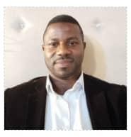
TITLE (PROF/DR/): MR.
NAME: SAMUEL AKINTOYE
POSITION: LECTURER II
SPECIALISATION: GEODESY, REMOTE SENSING & GEOMATICS
EDUCATION/TRAINING (Begin with Bachelor’s degree or other initial professional education, such as nursing, include postdoctoral training and residency training if applicable. Add/delete rows as necessary.)
INSTITUTION AND LOCATION
DEGREE
(if applicable)
Completion Date MM/YYYY
FIELD OF STUDY
University of Lagos- Akoka, Lagos Nigeria
B.Sc.
11/2008
Surveying & Geoinformatics
University of Lagos- Akoka, Lagos Nigeria
M.Sc.
03/2014
Surveying & Geoinformatics
University of Lagos- Akoka, Lagos Nigeria
Ph. D
In view
Surveying & Geoinformatics
Personal Statement
Mr. Samuel O. Akintoye is a registered Surveyor and Lecturer II in the Department of Surveying and Geoinformatics, University of Lagos. His academic and professional interests span engineering surveys, geodesy, geomatics, and real estate. He is committed to continuous learning and advancement, striving to bridge the gap between academia and industry. Mr. Akintoye is passionate about fostering excellence, innovation, and impactful research, particularly in inspiring the next generation of surveyors.
His current research focuses on a multi-sensor assessment of displacement and its drivers on the Lagos Third Mainland Bridge, integrating data from GNSS, Sentinel-1, and GRACE/GRACE-FO satellite missions.
Positions, Scientific Appointments, and Honours
Departmental Examination Officer, Surveying & Geoinformatics Department, University of Lagos| September, 2024 till date
Departmental Admissions on Officer, Surveying & Geoinformatics Department, University of Lagos| September, 2024 till date
Selected Most Recent Publications /Contributions to Knowledge
Akintoye, S. O., et al. (2022). Automatic road incidents detection and traffic management using artificial intelligence. Paper presented at the 3rd National Association of Surveying & Geoinformatics Lecturers (NASGL) Conference, Nigeria.
Akintoye, S. O., et al. (2021). Establishment of a geodetic network for deformation monitoring of the Third Mainland Bridge, Lagos, Nigeria. Paper presented at the Third Intercontinental Geoinformation Days (IGD), 17–18 November 2021, Mersin, Turkey.
O. T. Badejo et al, 2020. Modelling and Prediction of Water Current Using Artificial Neural Networks: A Case Study of The Commodore Channel. Nigerian Journal of Technology (NIJOTECH) Vol. 39, No. 3, July 2020.
O. T. Badejo & S. O. Akintoye, 2017. High and Low Water Prediction at Lagos Harbour, Nigeria. Nigerian Journal of Technology (NIJOTECH) Vol. 36, No. 3, July 2017.

